
Iceberg A-81 slows near South Georgia
A Terra/MODIS image from 20 October shows the iceberg beside the island’s underwater shelf. The report was published on 27 October.
RockGeo Editorial · Published on
Event date: 10/20/2026 · Source date: 10/27/2026
Sources accessed on 10/27/2026, 15:38 GMT
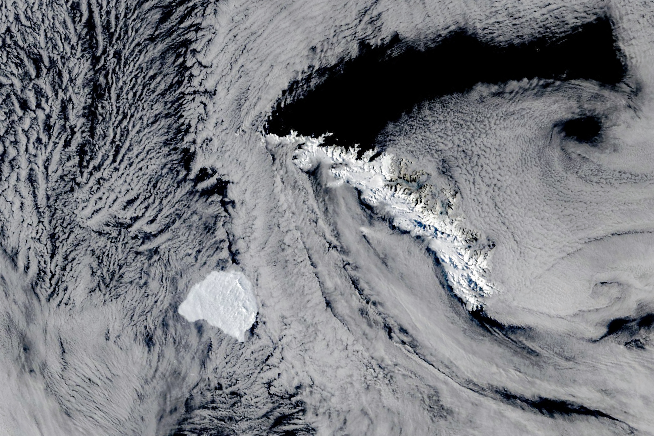
NASA Earth Observatory / Michala Garrison; MODIS data: NASA EOSDIS LANCE and GIBS/Worldview · NASA Media Usage Guidelines — factual editorial use
A Terra satellite image acquired by MODIS on 20 October 2026 shows Iceberg A-81 near South Georgia in the South Atlantic. In a report published on 27 October, Kathryn Hansen describes its slowdown beside the edge of the island’s underwater shelf. The image date differs from the publication date.
A-81 spent more than three years in the Weddell Sea, carried by the Weddell Gyre, before reaching the tip of the Antarctic Peninsula in May 2026. It then moved through the Scotia Sea. Approaching South Georgia, it was about 2,300 kilometres north-northwest of the Brunt Ice Shelf, where it originated.
Its origin is documented in a British Antarctic Survey release dated 23 January 2023. Separation occurred on 22 January between 19:00 and 20:00 GMT during a spring tide, when Chasm-1 crossed the Brunt Ice Shelf. The estimated area at calving was 1,550 km²; that historical figure is not a current measurement of the iceberg.
Brunt monitoring combines orbital imagery with field measurements. The 2023 release describes a network of 16 GPS instruments measuring deformation, alongside ice-penetrating radar and drone observations. Researchers also use models and bathymetric maps. These tools allow links between fracture evolution, ice motion and underwater terrain to be examined, rather than interpreting a photograph alone.
In the October analysis, Jan Lieser and Christopher Shuman considered that the iceberg appeared to be touching the shelf edge as it slowed. That wording preserves uncertainty: it confirms neither permanent grounding nor a future route. MODIS records the surface and includes clouds; it does not directly measure contact with the seabed or provide a real-time navigation warning.