
The crater that looks like a spider: Landsat reveals Australia’s Spider
NASA featured a September 20, 2026 image of Spider on October 13. Shock-deformed rocks help explain this ancient impact structure.
RockGeo Editorial · Published on
Event date: 10/13/2026 · Source date: 10/13/2026
Sources accessed on 10/13/2026, 15:01 GMT
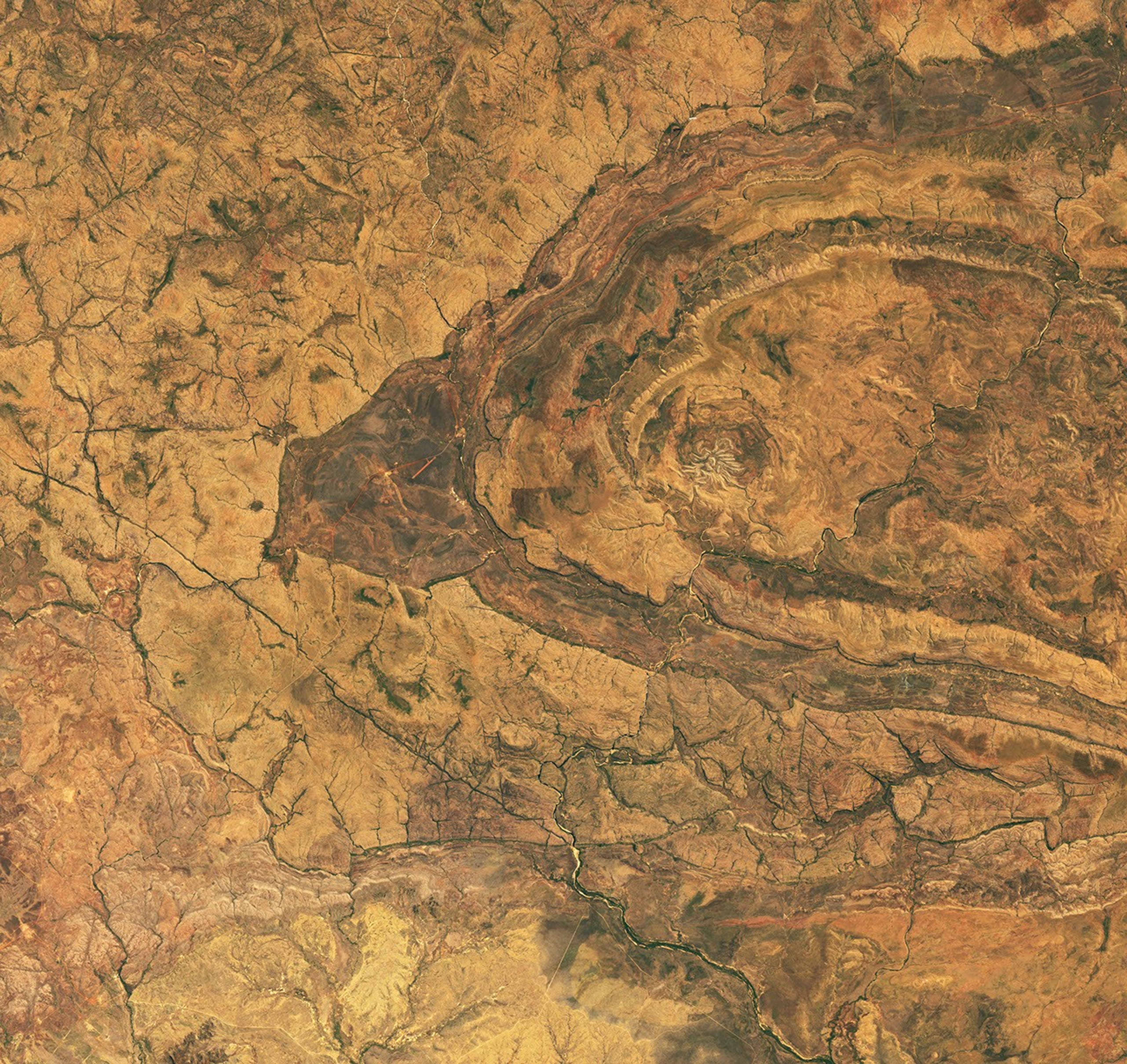
NASA Earth Observatory / Michala Garrison; Landsat data: USGS · NASA editorial use permitted under Media Usage Guidelines
NASA Earth Observatory published an image of the Spider structure in Western Australia’s Kimberley region on October 13, 2026. Lindsey Doermann’s story highlights a landscape shaped by impact and erosion. This is neither a recent meteorite fall nor a discovery made today.
The image was acquired on September 20, 2026 by OLI on Landsat 9, a NASA–USGS mission. The full structure measures approximately 13 by 11 km; the spiderlike central portion is about 4 km across. The light ridges are sandstone that survived the erosion of other layers.
A field survey conducted in 2007 and presented by Thomas Kenkmann and Michael Poelchau in 2013 investigated the central uplift. The authors described two imbricate thrust stacks around the core and shatter cones. These observations connect the pattern seen from space with deformation recorded in the rocks.
In a study published in 2021, Morgan A. Cox and colleagues analysed 453 zircon grains from 12 samples. Optical microscopy and electron backscatter diffraction, known as EBSD, allowed them to examine shock features in zircon and quartz. Nineteen zircon grains contained deformation twins in the {112} crystallographic orientation.
The distribution of these features in zircon was asymmetric relative to the structure’s centre, supporting an oblique-impact interpretation. The highest observed shock intensity did not coincide with the geographic centre. For mapping other craters, the result shows why sample locations matter as much as the overall shape of the terrain.
The impact age remains poorly constrained: the 2021 study places formation between approximately 610 and 900 million years ago, based on regional geology. The 2026 image documents today’s surface without providing a new age measurement. The case combines remote sensing, field observations and mineral analysis to investigate an ancient event.