
San Juan: river bends record a landscape’s history
An ISS photograph released by NASA highlights entrenched meanders in Utah. The bends illustrate links between rivers, rocks and uplift.
RockGeo Editorial · Published on
Event date: 10/06/2026 · Source date: 11/06/2026
Sources accessed on 11/06/2026, 15:15 GMT
NASA / ISS Crew Earth Observations Facility / Earth Science and Remote Sensing Unit, Johnson Space Center · NASA media usage guidelines — editorial use
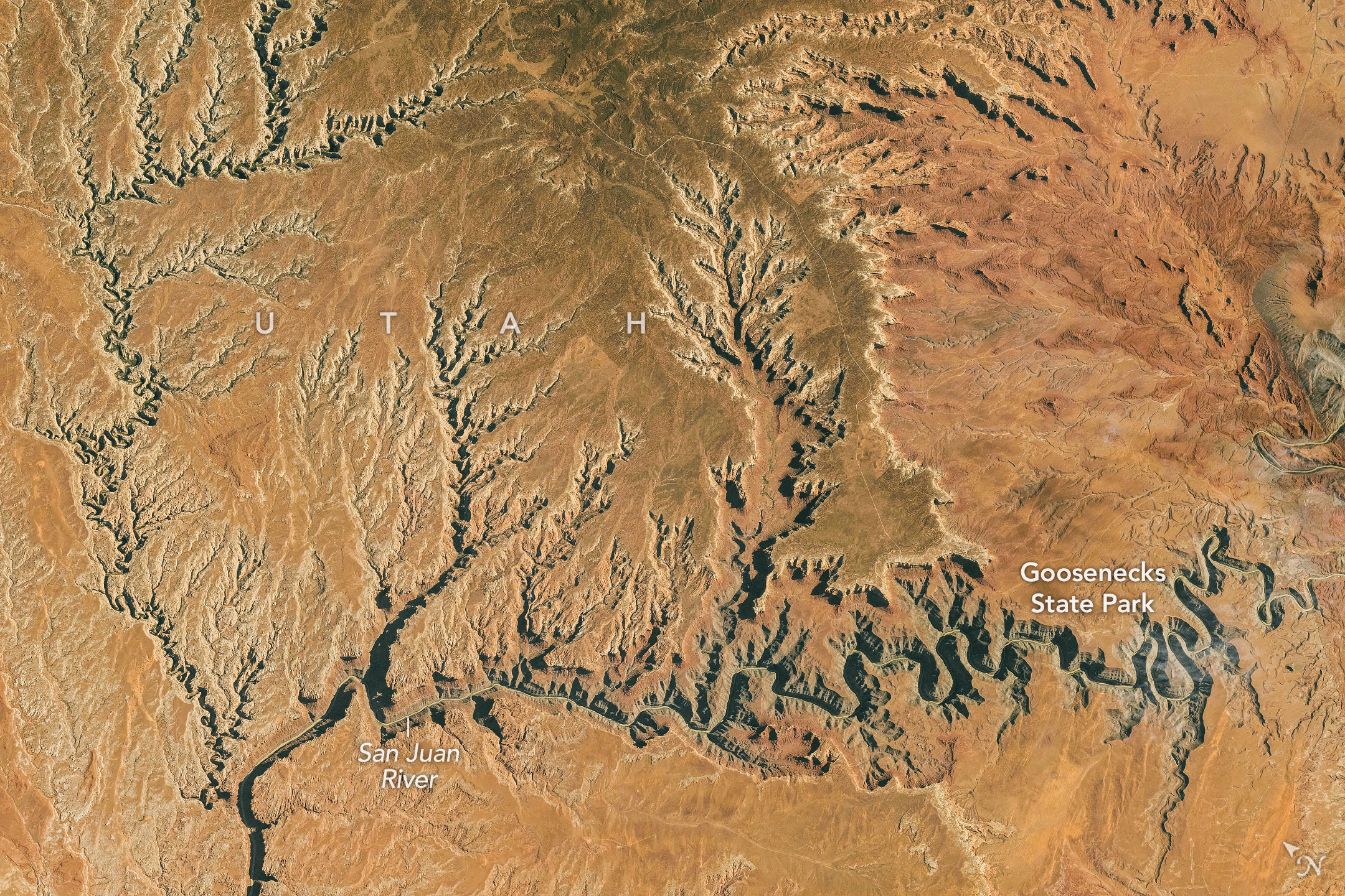
NASA Earth Observatory released a photograph of the San Juan River’s entrenched meanders in southern Utah, United States, on November 6, 2026. Lindsey Doermann’s account accompanies an International Space Station observation made on October 6, distinguishing the image acquisition date from its publication.
At Goosenecks State Park, the canyon is about 300 m deep. In one stretch described by NASA, the river travels 8.9 km between points just 2.1 km apart in a straight line. The contrast illustrates how much the channel lengthens as it follows the bends.
The geological explanation combines two stages. According to Marshall Robinson of the Utah Geological Survey, an ancestral river meandered across relatively flat terrain. The rocks originated in a marine environment, with repeated sea-level changes before the sea withdrew. The gentle gradient favoured a winding course.
The walls expose the Paradox and Honaker Trail formations, with rocks more than 300 million years old. Limestone, siltstone, sandstone and shale make up the cliff- and slope-forming sequences. The age of these rocks is not the age of the canyon: they already existed when the river deepened its bed.
Subsequent uplift of the Colorado Plateau raised the headwaters and increased gradient, velocity and downcutting. The river retained its bends as it cut downward. The geological survey places this stage approximately 15–20 million years ago, emphasizing that its timing remains debated.
Photograph ISS075-E-188830 was taken with a Nikon Z9 at a focal length of 400 mm. The orbital view documents the geometry of the channel and nearby valleys; historical interpretation relies on the geological context provided by the sources. A single image does not provide a current erosion rate.