
Cyprus: from ocean floor to Akrotiri Peninsula
A Landsat image released by NASA connects Troodos’ oceanic rocks with the sedimentary history of southern Cyprus.
RockGeo Editorial · Published on
Event date: 10/10/2026 · Source date: 11/05/2026
Sources accessed on 11/07/2026, 15:07 GMT
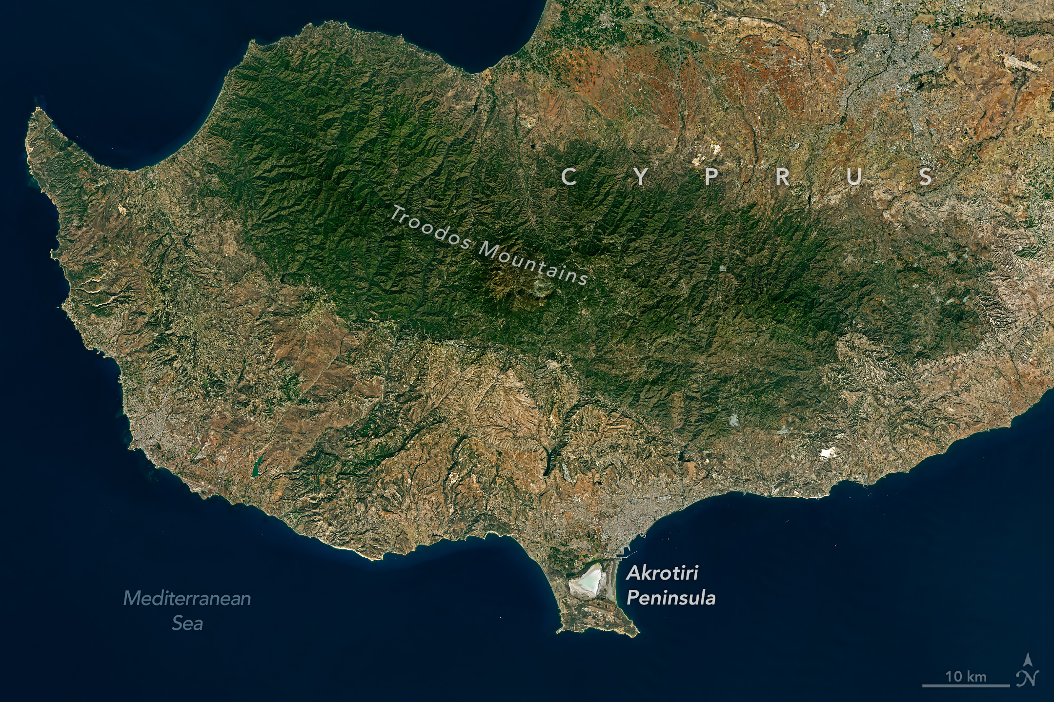
NASA Earth Observatory / Michala Garrison; Landsat / USGS · NASA media usage guidelines — editorial use
NASA Earth Observatory released images of Cyprus on November 5, 2026, acquired by Landsat 8 on October 10. Adam Voiland’s account connects the Troodos landscape with the oceanic origin of its rocks and the sedimentary construction of Akrotiri Peninsula in the island’s south.
According to the Geological Society of London, Troodos belongs to an ophiolite complex: a fragment of the oceanic domain uplifted and exposed on land. Its rocks formed on the floor of the Tethys Ocean about 92 million years ago, during the Cretaceous. Their formation age is not the date when the entire present landscape emerged.
Uplift and erosion exposed a sequence allowing mantle and oceanic-crust materials to be studied on land. The institution describes Troodos as an analogue for modern seafloor processes, including hydrothermal mineralization. Superheated seawater interacts with igneous rocks, transports metals and deposits them as it emerges onto the seafloor, forming copper- and pyrite-rich deposits.
The coastal history involves younger materials. During the Miocene, layers of chalk, limestone, marl and other marine sediments accumulated around the island. Later uplift produced a smaller island to the south; river and marine deposits progressively filled the channel separating it from Cyprus.
Two sedimentary connections, known as tombolos, eventually formed Akrotiri. The western tombolo, associated with the Kouris River, began developing approximately 50,000 years ago. The eastern closure of the former sea inlet occurred only within the past 2,000 years, according to NASA’s synthesis. Akrotiri Salt Lake lies between them.
Michala Garrison produced the images using OLI instrument and USGS data. They record the configuration observed in October, when seasonal rains were starting to fill the lake. The scene provides spatial context; on its own, it measures neither uplift velocity nor sedimentation rate or present conditions.