
Magnitude 6.9 earthquake occurs 135 km deep in Russia
USGS located the event 76 km northeast of Ozernovskiy on October 16 at 03:35:31 GMT. Parameters and the intensity map are preliminary.
RockGeo Editorial · Published on
Event date: 10/16/2026, 03:35 GMT · Source date: 10/16/2026
Sources accessed on 10/16/2026, 19:59 GMT
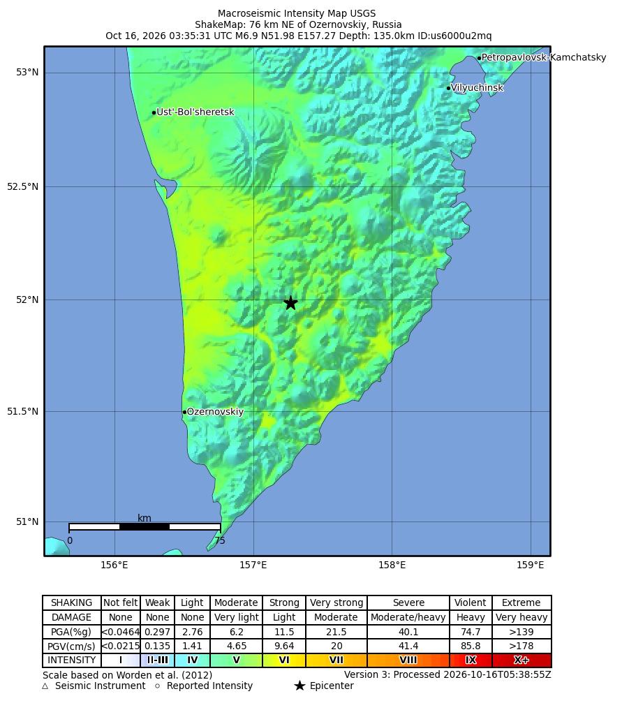
USGS / ShakeMap · Public domain — USGS
USGS recorded a magnitude 6.9 earthquake on October 16, 2026 at 03:35:31.925 GMT, 76 km northeast of Ozernovskiy, Russia. The catalogue identifies event us6000u2mq, with magnitude type mww and a depth of 135 km. The epicentre was located at 51.9848° N, 157.2701° E. These figures describe the consulted solution, not definitive parameters.
The origin is marked reviewed, but its evaluation status remains preliminary. The product states that depth was obtained by modelling broadband P waveforms. The location solution uses 188 stations and lists a horizontal error of 8.69 km. Analyst review and preliminary status can coexist; new information may still change the catalogue.
The available ShakeMap is automatic: version 3 was processed at 05:38:55 GMT on October 16. The figure preserves the official product’s epicentre, scale, colours and legend. It represents the estimated distribution of shaking intensity. The table of effects associated with colours does not confirm observed damage in this event, and the map is not a photograph.
Magnitude summarises the size of an earthquake, whereas intensity describes shaking at each location. According to USGS, intensity varies with distance, rupture characteristics and surface geology. Magnitude 6.9 therefore does not imply equal intensity everywhere: interpreting the map requires its legend and the location of each point.
Under the USGS depth classification, 135 km is intermediate, within the 70–300 km range. Depth describes the focus inside Earth and differs from horizontal distance to the epicentre. This distinction helps interpret the record without treating the event as a shallow rupture.