
Sentinel-3 reveals a sea-ice mosaic beside the Antarctic Peninsula
An image from September 30, released by ESA on October 16, shows ice floes and clouds in West Antarctica. It is a satellite record, not a real-time observation.
RockGeo Editorial · Published on
Event date: 09/30/2026 · Source date: 10/16/2026
Sources accessed on 10/18/2026, 19:59 GMT
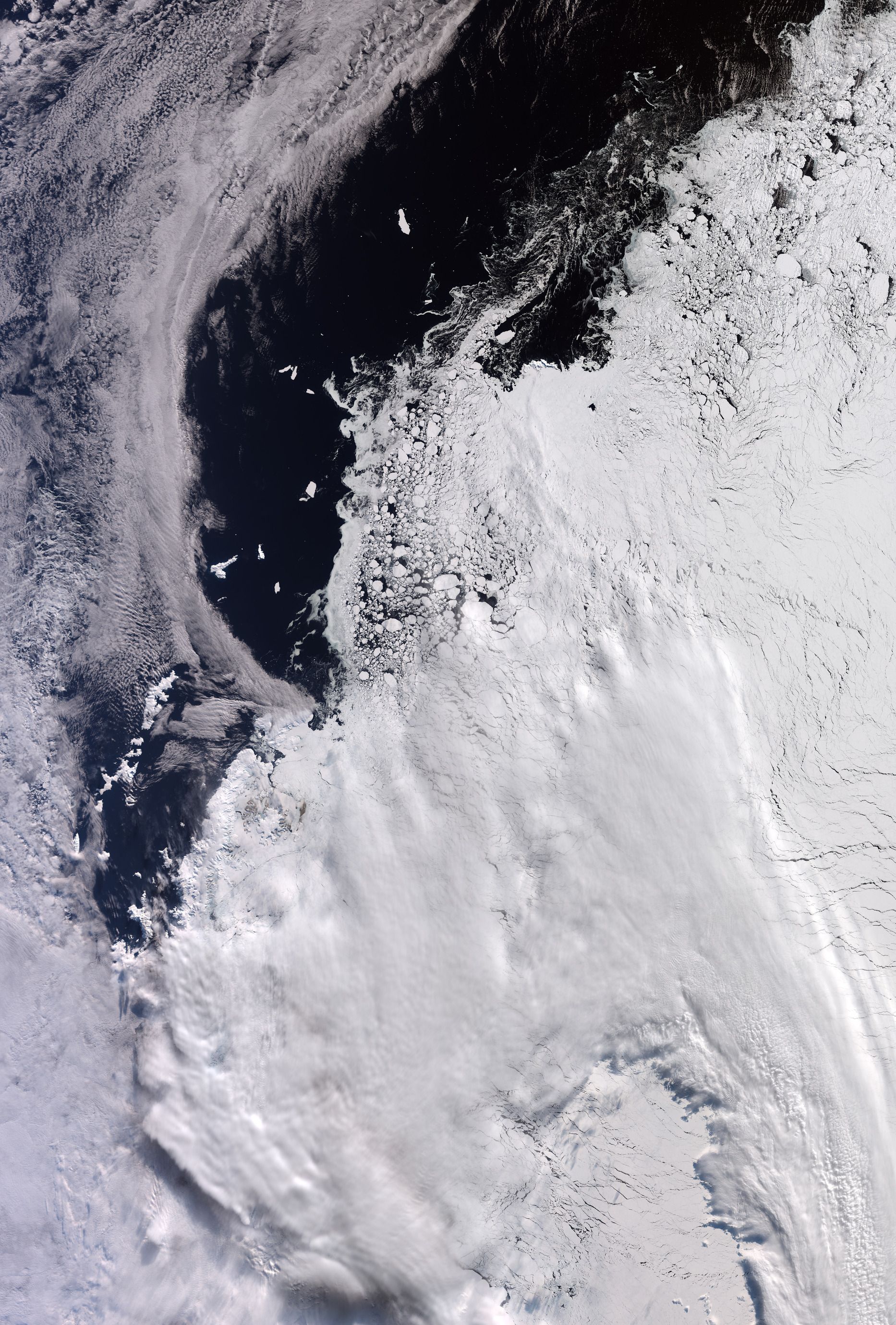
contains modified Copernicus Sentinel data (2026), processed by ESA · CC BY-SA 3.0 IGO
On October 16, 2026, ESA released a Copernicus Sentinel-3 image acquired on September 30 over part of West Antarctica. The scene includes the tip of the Antarctic Peninsula and part of the Weddell Sea to the east. These dates distinguish the observed moment from publication: the record does not show today’s conditions.
The frame covers approximately 1,200 by 1,700 kilometres. Elephant Island, about 50 kilometres long, appears on the left against ice-free ocean. This geographical reference helps convey the dimensions of the larger floes, some comparable to the island, without treating their apparent size on a page as an independent measurement.
ESA’s description highlights tightly packed ice on the right and smaller fragments forming swirling patterns in the ocean. White clouds cover much of the lower area, so not every white surface should be read as ice. The varied textures make the scene interesting, but cloud cover limits what can be seen directly.
The Sentinel-3 mission systematically measures oceans, land, ice and atmosphere using a suite of instruments. ESA says its aims include monitoring large-scale global dynamics and providing near-real-time information for ocean and weather forecasting. That mission capability does not turn an archive image into a current bulletin or, by itself, identify the instrument used for this scene.
Geoscientific interpretation requires keeping observation, location and interpretation distinct. This scene visually illustrates how ice, ocean and clouds coexist over a large area; it is not an estimate of all Antarctic ice cover. Comparing conditions over time requires systematic observations, the mission’s stated scope, rather than a conclusion based on this frame alone.