
Satellite shows Amazon smoke; some fires evade detection
An October 12 MODIS image shows smoke over the Amazon. An October 15 report links activity to drought and explains monitoring gaps.
RockGeo Editorial · Published on
Event date: 10/12/2026 · Source date: 10/15/2026
Sources accessed on 10/15/2026, 15:08 GMT
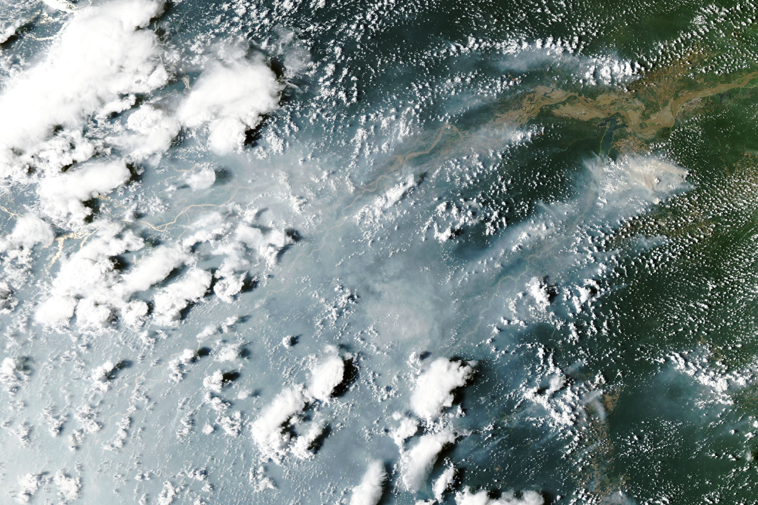
NASA Earth Observatory / Lauren Dauphin; MODIS: NASA EOSDIS LANCE / GIBS / Worldview · NASA editorial media usage guidelines
An image from MODIS aboard Aqua shows smoke over the Amazon on October 12, 2026. Adam Voiland’s NASA Earth Observatory report, published October 15, describes increased fires and emissions since September in the central and eastern basin, including areas around Manaus and Santarém, Brazil.
The analysis links drought to El Niño and a tropical fire sequence: first Indonesia, then this part of the Amazon. Researcher Douglas Morton points to possible expansion farther north in November and December. This is an expectation, not confirmation of new fires in those locations.
Using satellite observations, researcher Shane Coffield estimates 50 to 70 uncontrolled fires around Santarém. A search for additional signals in VIIRS data identified about 40% more candidate fires than FIRMS active-fire counts in that area. Smoke, clouds and canopy can obscure the infrared signal, especially from lower-intensity understory fires.
Interpreting maps requires distinguishing heat detection from actual fire size. FIRMS technical documentation explains that a MODIS point represents the centre of an approximately 1 km pixel containing one or more thermal sources. The coordinate need not coincide with the fire, and does not mean the entire pixel is burning.
Pixel size also varies with position within the sensor’s observation swath. Viewing angle, cloud cover, smoke and surface characteristics affect what can be detected. FIRMS advises against estimating burned area directly from active-fire detections. These limits help prevent point counts being presented as a measure of extent or a complete fire inventory.