
Magnitude 7.0 earthquake strikes Tibetan Plateau
USGS recorded the event at 14:33:40 GMT on 22 October, at a depth of 18 km. Preliminary data indicate normal faulting.
RockGeo Editorial · Published on
Event date: 10/22/2026 · Source date: 10/22/2026
Sources accessed on 10/22/2026, 19:59 GMT
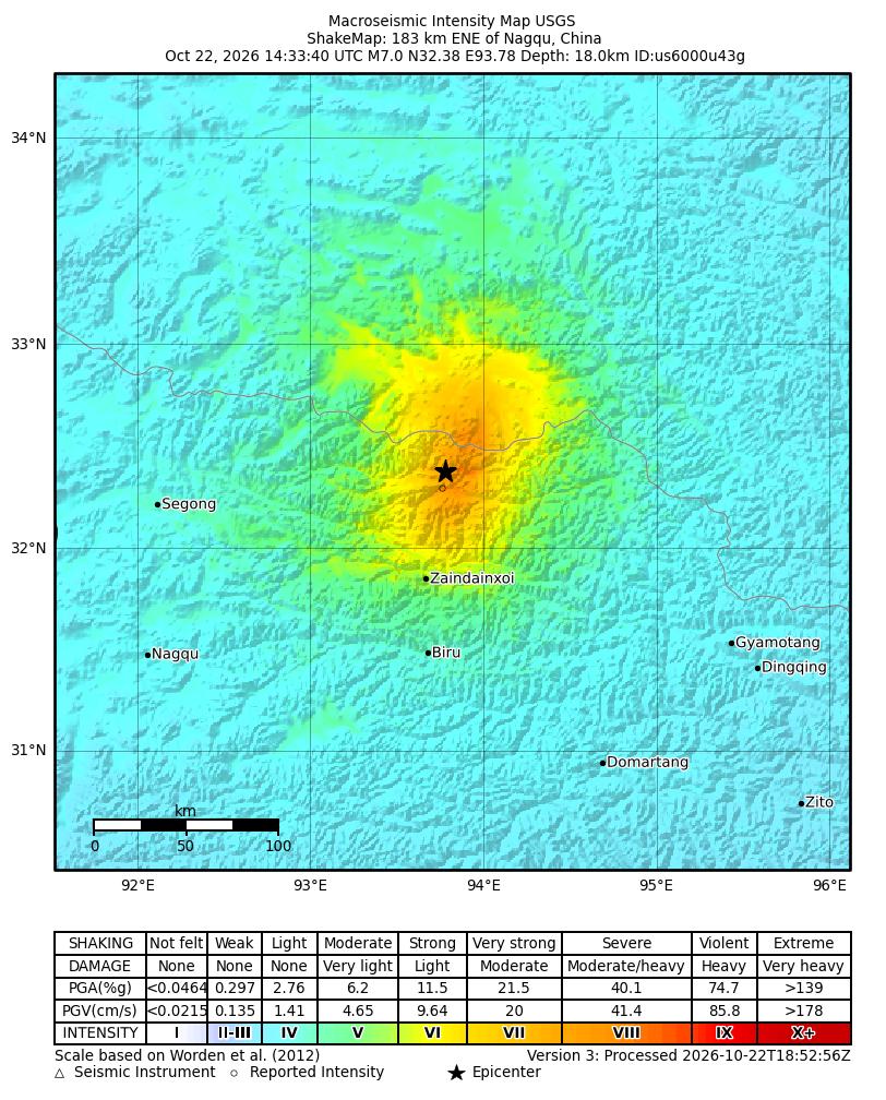
USGS / NEIC ShakeMap · Public Domain
USGS recorded a magnitude 7.0 earthquake on the Tibetan Plateau, China, on 22 October 2026 at 14:33:40 GMT. Event us6000u43g had an estimated depth of 18 km and an epicentre at 32.3805° N and 93.7797° E. The catalogue placed it 191 km east-northeast of Nagqu. These parameters are preliminary and may be revised.
The official tectonic summary attributes the earthquake to normal faulting within the plateau crust. Moment-tensor solutions allow two possible fault-plane orientations: a moderate dip to the northwest or southeast. The statement does not identify a single one of these alternatives; this report therefore does not assign the earthquake to a named fault or a specific surface trace.
The regional setting requires distinguishing collision from internal deformation. India–Eurasia convergence drives uplift of the Himalaya and Tibetan Plateau. At the same time, the plateau’s high gravitational potential energy favours east–west extension. USGS describes this event’s normal mechanism as consistent with that extension, regionally accommodated by normal and strike-slip faults.
The reproduced map is automatic ShakeMap version 3, processed at 18:52:56 GMT on 22 October. It represents estimated shaking intensity rather than a photograph of effects. We retain the original heading, which shows 183 km from Nagqu, while the consulted catalogue gives 191 km. Scale, coordinates, colours and legend remain complete, without artificially harmonising different product versions.
The origin product was reviewed but its evaluation remained preliminary; the map was automatic. USGS cautions that these estimates may contain errors and do not replace observations of effects on people or buildings. The same intensity can also produce different impacts depending on structures and local conditions. This report does not confirm damage or casualties from map colours or impact models.