
Sentinel-3C shows Rachel in false colour
On October 19 ESA released an image of Rachel captured on October 2 by the SLSTR radiometer. Red represents vegetation in the composite, not temperature or fires.
RockGeo Editorial · Published on
Event date: 10/02/2026 · Source date: 10/19/2026
Sources accessed on 10/19/2026, 15:00 GMT
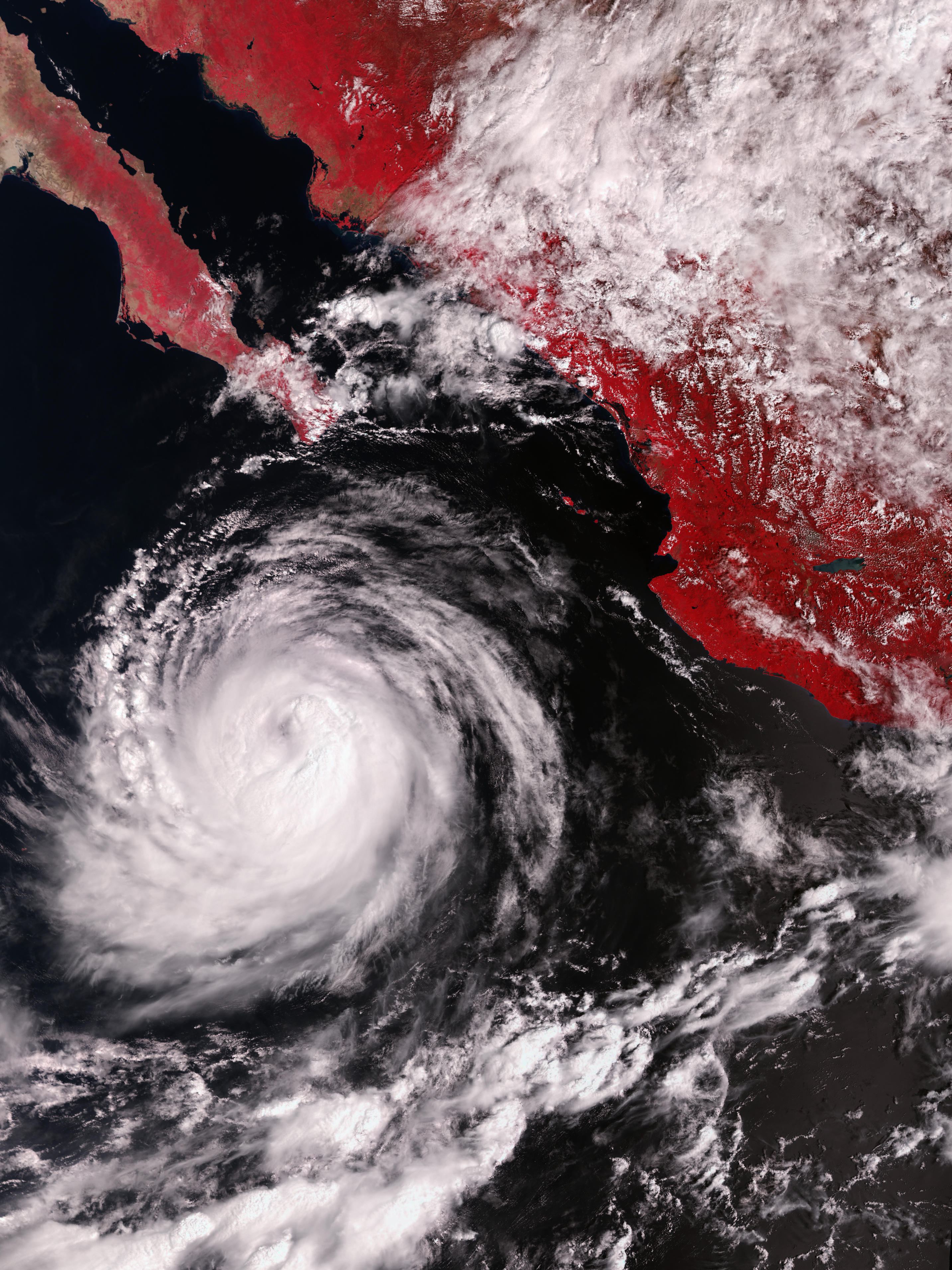
© ESA — contains modified Copernicus Sentinel data (2026), processed by ESA · ESA Standard Licence — editorial use
On October 19, 2026, ESA released an image of Hurricane Rachel captured on October 2 by the Sea and Land Surface Temperature Radiometer, SLSTR, on Copernicus Sentinel-3C. The scene shows the eastern Pacific off Mexico and the Baja California Peninsula. The news is the instrument demonstration during commissioning, not a current storm bulletin.
The composite uses false colour, with land vegetation appearing red. That red is neither a heat scale nor a fire map. ESA presents the scene as an early glimpse from the radiometer’s visible channels; images using its thermal channels were still to follow, according to the release.
SLSTR observes Earth in nine spectral bands spanning visible, shortwave infrared and thermal infrared wavelengths, plus two dedicated fire-detection channels. Its main role is to measure sea- and land-surface temperatures using thermal channels. Visible channels help detect clouds and prevent them from contaminating those measurements.
The Sentinel-3 mission combines instruments to measure oceans, land, ice and atmosphere. ESA’s documentation links sea-surface temperature, colour and height measurements to environmental monitoring and describes land applications including land use, vegetation and river and lake height. These are mission functions, not quantitative results extracted from this Rachel image.
Sentinel-3C launched on September 15, 2026, to continue the series. ESA says that after commissioning the mission is jointly managed with Eumetsat, with data open to users worldwide. Distinguishing an early test from operational service matters: the image documents a preparation milestone without representing final availability of every product.